Aaron Barkhurst

Aaron Barkhurst

Full Stack Developer

Developer and manager with 15 years of professional GIS/geospatial analysis
and 11 years of software development experience.

Husband and father of two located in the beautiful mountains of West Virginia.


Experience

I began my career "pointing and clicking" in commercial off-the-shelf applications (COTS); now, a decade later, I'm an on-the-job self-taught full-stack developer. I learned to program first in Python for GIS; then moved to web development for web mapping applications. Now, I work daily in the front-end and back-end using javascript frameworks and am very passionate about continually learning new software and languages.

Advanced Software Technologies Supervisor

Mid-Atlantic Technology, Research & Innovation Center (MATRIC)

Full stack developer responsible for numerous applications including: BLOSOM, CSIL, Offshore Storage Calculator, NETL COP, and GeoCube. Plays active role in team and customer coordination and communication.

Responsible for the development across the full tech stack (e.g task tracking, documentation, testing, UI, database management, APIs, server administration, deployment). Coordinate with a team of NETL researchers to integrate research logic, models, and ideas into custom web accessible frameworks and tools. development of project applications and analysis models utilizing PostgreSQL with PostGIS, GraphQL, Apollo Server & Client, Express API, Fastify API, Node.js, Docker, Vue.js, Nuxt.js, Vuex, SvelteKit, TailwindCSS, Mapbox GL JS, Tippecanoe vector tile CLI, D3.js, Greensock, Python programming language, HTML5, CSS, JavaScript, JIRA, Git, Cypress, Jest, and CI/CD.

2018 - Present

Geospatial Analyst III

MID-ATLANTIC TECHNOLOGY, RESEARCH & INNOVATION CENTER (MATRIC)

Development of project applications and analysis models utilizing ESRI software products, ArcGIS API for Flex, ArcGIS API for JavaScript, Flash, Python programming language, Python web frameworks (e.g. Django), ArcObjects .NET in C#, MVC/MVVC frameworks (e.g. ExtJS), HTML5, JavaScript, SQL Server, PostgreSQL, and Couchbase NoSQL database.

2010 - 2018

Manager of Production Operations

ImageTree Corp. (venture-funded forestry-technology startup)

Lead a highly productive team of 8-10 employees responsible for the development, management, and acquisition of all GIS related data including organization, attribution, and file format correctness. Cross-department coordination of tasks, responsibilities, and data organization and delivery.

2006 - 2009

Projects

Select Sampling of Work Product

COP Viewer

Description: The Common Operating Platform (COP) is a web mapping and visualization platform that provides access to data and tools in a virtualized environment.

Tech stack: Nuxt.js, Vue.js, Vuetify, Mapbox GL JS, Greensock, Vuex, Apollo Client, Hasura, GraphQL, PostgreSQL w/PostGIS, Express, Node.js, Docker, Python, Git

GeoCube

Description: Geocube is a flexible, customizable web mapping application that concatenates key spatial datasets and information relevant to energy research needs for a given region. The Geocube connects users to data collections and resources spanning the subsurface to the surface. Users have the flexibility to view public data collections, as well as develop, save, and export their own maps via Geocube.

Tech stack: Nuxt.js, Vue.js, Vuetify, Mapbox GL JS, D3.js, Greensock, Vuex, Apollo Client, PapaParse, Apollo Server, GraphQL, PostgreSQL w/PostGIS, Express, Node.js, Docker, Git

CSIL

Description: Cumulative Spatial Impact Layers (CSIL) is a spatial tool that rapidly identifies and quantifies potential socio-economic and environmental vulnerabilities within a given area. The CSIL tool summarizes overlapping datasets based on presence/absence, density, or by numeric attributes. Providing an efficient summation of disparate geospatial data, CSIL bridges the gap between understanding data and analysis.

Tech stack: Nuxt.js, Vue.js, Vuetify, Mapbox GL JS, HighCharts, Vuex, Apollo Client, Hasura, GraphQL, PostgreSQL w/PostGIS, Express, Node.js, Docker, Git

OSC Desktop Version

Description: The Offshore CO2 Saline Storage Calculator application is bundled for desktop using Electron for the UI and PyInstaller for the Python logic and dependencies. The Offshore CO2 Saline Storage Calculator is a data-driven tool that applies the adapted DOE CO2 Methodology to calculate all potential distributions of offshore storage efficiency and resource potential at multiple spatial scales for saline formations. The tailored methodology include accounting for changing CO2 density with the overlying water column and sediment differences in unlithified, porous, and permeable offshore saline formations.

Tech stack: Electron, Quasar, Vue.js, ApexCharts, Vuex, PapaParse, WiX Toolset, PyInstaller, Git

OSC Web Version

Description: A web hosted version of the The Offshore CO2 Saline Storage Calculator made availabe via the Geocube application.

Tech stack: Nuxt.js, Vue.js, Vuetify, D3.js, Apollo Client, PapaParse, Apollo Server,GraphQL, PostgreSQL w/PostGIS, Docker, Git

Awards

  • 2020 R&D 100 Award
    Project: Offshore Risk Modeling (ORM) Suite

    The R&D 100 Awards have served as the most prestigious innovation awards program for the past 56 years, honoring great R&D pioneers and their revolutionary ideas in science and technology. MATRIC was part of the Department of Energy’s (DOE) National Energy Technology Laboratory (NETL) team, in collaboration with other national laboratories, that developed an Offshore Risk Modeling Suite that was recognized by R&D Magazine as one of the 100 most technologically significant products introduced into the marketplace in the past year.
  • 2019 Carnegie Science Innovation in Energy Award
    Project: Global Oil & Gas Infrastructure Database

    The National Energy Technology Laboratory (NETL) Global Oil and Gas Infrastructure (GOGI) Team was honored by the Carnegie Science Center with its “Innovation in Energy” Award. MATRIC’s Aaron Barkhurst and Vic Baker supported the award-winning NETL team, providing Geographical Information System (GIS) expertise and Big Data analysis. MATRIC supported NETL as a team member on the Information Technology Support Services (ITSS) contract primed by Attain, LLC.
  • Ford Ironman Triathlon Finisher

Publications and Presentations

Author/Contributor of 13 resources available on OSTI.gov, including the following:
  • Offshore CO2 Storage Calculator
    Publication date: Mar 21, 2020   National Energy Technology Laboratory - Energy Data eXchange; NETL
  • Geocube
    Publication date: Jun 30, 2018   National Energy Technology Laboratory - Energy Data eXchange; NETL
  • Global Oil & Gas Infrastructure Database
    Publication date: Mar 20, 2018 National Energy Technology Laboratory - Energy Data eXchange; NETL

See full list of publications and presentations available on U.S. Department of Energy Office of Scientific and Technical Information

Technologies

Front-End Architecture, UI, & Programming

Vuex , Web Workers , JS ES6+ and more...

Back-End Architecture, Programming, Languages & Tools

Fastify , Cherrypy and more...

Data Visualization, Mapping and Animations

ApexCharts.js , Apache ECharts , Tippecanoe CLI , ArcGIS API for Javascript , ESRI GIS & Mapping Products and more...

Development Environment & Testing Tools

Cypress , Husky , Hygen , CI/CD , and more...

Workflow + Skills
  • Test Driven Development
  • Cross Functional Teams
  • Container-Based Deployments (Docker)
  • Agile Development & Scrum, CI/CD
  • Reusable, Modular Code -- self-readable and concise technical docs for training
  • Self-driven, constant learning mindset
  • Product performance and enhancement minded
  • Strong writing and verbal communication skills

Education

Master of Agriculture

West Virginia University

Emphasis: Natural Resource Management using GEOGRAPHIC INFORMATION SYSTEMS (GIS) Applications

Research Project involved the study of the West Virginia Northern Flying Squirrel using GIS technology. Course work specializing in: natural resource law, environmental regulation, environmental impact assessment, watershed management, applied global information systems (GIS) for environmental management, advanced spatial analysis for resource management, consulting forestry, advanced wildlife population ecology, research methods, and statistical applications.

2005 - 2006

Bachelor of Science

West Virginia University

Emphasis: Natural Resource Management using GEOGRAPHIC INFORMATION SYSTEMS (GIS) Applications

Course work specializing in: recreation and parks, recreation services for special populations, program planning, recreational leadership, interpretation and public speaking, resource economics, ecotourism, dendrology, wildland recreation management, wildlife management, forest management, and wildlife policies.

2000 - 2005


Interests

Day-to-Day

Most days you'll find me listening to my favorite tech podcasts, hanging out with my kids (there's lots of kickball, LEGO, bike rides and dolls) and my wife (we're learning to dance the hustle), tying flies and learning guitar chords.

If you’re into listening to podcasts and are looking for some new options that are full of great content, I recommend Enjoy the Vue, Views on Vue, Svelte Radio, Web Rush, JavaScript Jabber, Syntax, and Wet Fly Swing Fly Fishing.

Hobbies

This summer, I spent my weekends on the lake with my family and friends, perfecting my backflip, tube-pulling skills, and enjoying the world-class company.

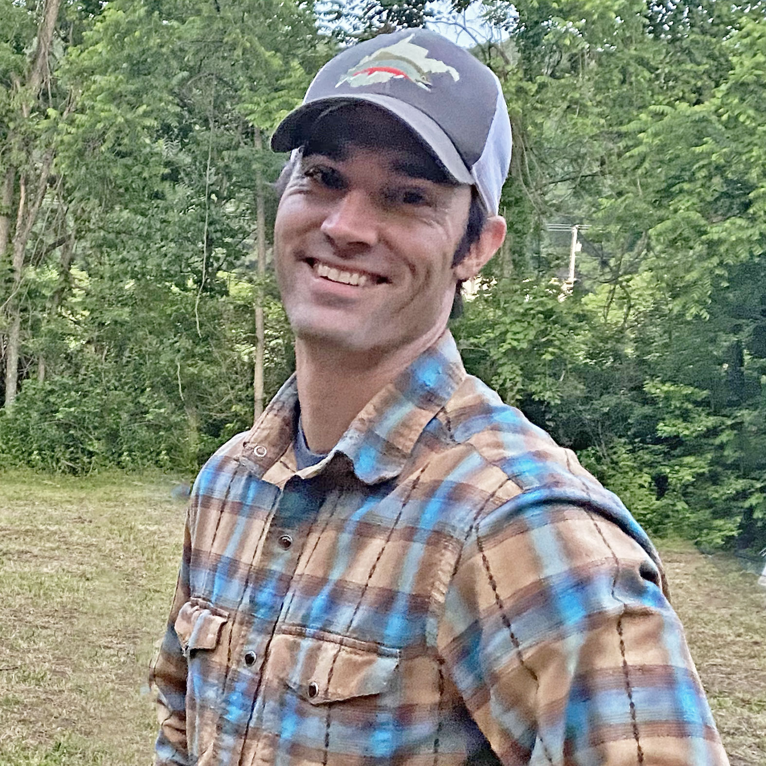
I check-in with my fishing buddies daily -- along with checking water guages, weather, and upcoming stream conditions. Whenever I can sneak away, you'll find me on a native or wild trout stream, fly rod in hand!

I also enjoy whitewater kayaking, rock climbing, backpacking, snowboarding, cycling, triathlon, music, and travel.


Get in Touch